Showing posts with label Wahluke. Show all posts

Friday, December 27, 2024

NP Wahluke Branch Photos

Guest post by Jena Gilman.


I was out hiking on the Hanford Reach National Monument Friday and was able to follow the roadbed of the proposed NP Wahluke Branch for about a mile and a half a couple miles south of the point where Grant, Adams and Franklin Counties come together. Here are some photos.  It was obvious that the rail had never been laid as there was no sign of discarded spikes or fish plates.  The only hardware I saw were culverts.


Saturday, January 6, 2024

Friday, September 22, 2023

Wahluke Branch Alternate Route

Info courtesy of Dean Ferris. 

"There was another alignment for this line out of Eltopia that NP bought the land for. It joined with the actual line around half way between Mesa and Basin City. If anyone's interested I'll post a map showing that alignment. This came up as a question at work recently - a farmer wanted to buy a portion of the right of way, but no abandonment could be found. The question came to me, and I was able to figure out that the reason it was never abandoned is because it was never built..."


Green is still owned by BNSF. Blue has been sold off.


"The property for the Eltopia to Basin City right of way was acquired in the early 1960's, the Mesa alignment was acquired in the mid 1960's. I'm uncertain as to why this happened other than the Mesa alignment was shorter, but it was certainly more challenging from an engineering standpoint."

Tuesday, July 26, 2022

BN AFE Index Card--Wahluke

Courtesy of the PNRA and Aaron Schwarz.

A delightfully short list. NP era AFE's are in the works.


Saturday, December 29, 2018

Notes On The Wahluke Branch

From the NP Telltale List.


Nov 5, 2002

The old NP track profiles for the Wahluke Slope Branch show the end of the prepared grade at MP 53.29, with a future end at MP 54.75. I don't believe the track was ever laid beyond MP 21.33, which was identified as Sagehill. However, the grade and (the few) bridges were built to the end of the prepared grade. The bridges were all heavy design, and were salvaged and re-used at other locations in the 1980's. Your recollection is correct that the line was well built, as the rail was second-hand 112 lb. welded (with a laid date of 1969), and the ballast was crushed rock from Cactus Pit, which is ballast still used on the mainline today.

My recollection is that the line was not used beyond Basin City from the mid 70's due to a slide in the vicinity of MP 11 or 12, although you could hi-rail on both sides of the slide. The line was removed between Sagehill and MP 11.20 by AFE 83-947, and some time later was removed to MP 10.0, about 1.5 miles west of Basin City. I haven't been over there in quite a few years, but the current BNSF track chart still shows the line in place from Mesa to MP 10, and the current Northwest Division timetable has a reference to the Basin City Stub.

Glen XXXX

Saturday, February 17, 2018

Wahluke Line Approved

Courtesy of the NP Telltale.

From:
Along the Northern Pacific Railway's Mainstreet, Vol. 1, No. 5,
November, 1967, p. 1.


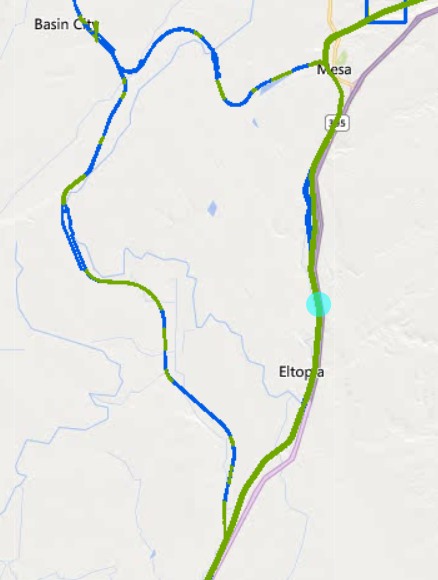
Authorization to build a 55-mile branch line to serve the Wahluke
Slope area in Grant County, Wash., was received by the Northern
Pacific from the Interstate Commerce Commission on Oct. 5.
Completion of the branch line construction will enable the
Northern Pacific to provide direct rail service to and from a newly
developing agricultural area which is to receive extensive irrigation
through the Columbia Basin Project.
On acknowledging the action by the ICC, Dean H. Eastman,
Northern Pacific vice president and western counsel, said the company
is particularly pleased to receive authority for construction of the
line, and that it is a natural extension of current Northern Pacific
operations in the Columbia Basin and Tri-Cities area of Richland,
Pasco and Kennewick, Wash.
"Pasco is geographically the natural trading center for produce
from the Wahluke Slope and without direct rail access to the Tri-
Cities," he said, "the Slope would not realize its economic
potential."
Eastman said further that fruit ranches located on the Slope
will be very closely allied to the mature fruit industry of the
Yakima Valley for marketing, purchasing of supplies and for storage.
The area to be served by the railway includes 41,000 acres now
under irrigation in the Basin City area. More than 128,000 acres will
be under irrigation in the area by 1973.
Kenneth L. Cook, Northern Pacific director of agricultural
development, said the area is potentially one of the richest
agricultural producing areas in the Pacific Northwest. He predicts
that the area will soon produce some of the highest yields ever
recorded in the Pacific Northwest for several kinds of row crops
because of favorable soil and climate conditions and an exceptionally
long growing season.
The major irrigation development in the Columbia Basin Project
for the next 8 to 10 years will be in the Wahluke Slope area.
Construction of the branch line is expected to cost about $5
million. It is believe that the new stretch of track will be among
the longest constructed by any major railroad in recent years, and
railway officials said work on the new line would start as soon as
all legal problems are resolved.
The ICC denied an application from the Milwaukee Road, which
had been competing with the Northern Pacific for rights to serve the
Wahluke Slope area.

Thursday, October 16, 2014

BNSF Track Segment 454

Compiled by the late Alan Eisenberg.

Red indicated that the station was abandoned at the time of compilation.


Tuesday, October 14, 2014

BNSF Track Segment 454

Compiled by the late Alan Eisenberg.

Red indicated the line was abandoned at the time of the compilation.